Introduction
Geography is the study of Earth’s land, water, people, and other living things. It is important to know the world around you. Geography plays a part in where and how people live.
Below are key terms, important to the lessons to follow.
The Sky Islands are a series of forested mountain ranges surrounded by “seas” of desert and grasslands.
A wash is a dry river, stream, creek bed or gulch that temporarily fills with or flows with water after heavy seasonal rains. In Spanish a wash is called an arroyo.
Topography is the graphic representation on a map of the surface features of a place or region; included are the relative positions of mountains, valleys, plains, bodies of water and elevations.
A watershed is an area or region (bounded by high elevation points) drained by a river, river system, or other body of water. Each watershed has its own network of river and stream channels that drain water from and through a particular basin.
Biomes
Biomes Data Table
Excerpt of an Arizona Geographic Alliance Lesson

AZ Rivers, Streams, Etc.
A wash is a dry river, stream, creek bed or gulch that temporarily fills with or flows with water after heavy seasonal rains. In Spanish a wash is called an arroyo.
Topography is the graphic representation on a map of the surface features of a place or region; included are the relative positions of mountains, valleys, plains, bodies of water and elevations.
A watershed is an area or region (bounded by high elevation points) drained by a river, river system, or other body of water. Each watershed has its own network of river and stream channels that drain water from and through a particular basin.
Watershed Report Guidelines
Bill Williams River
Include the following types of information in your report:
- Visuals of flora and fauna native to the watershed; fish and fowl are native to the area
- Smaller tributaries (creeks, and/or lakes not included in the principal tributaries labeled on the map)
- Data about the principal bodies of water in the watershed (i.e. length and width of the rivers, etc.)
- Cities and/or towns located within the watershed
- Significant landforms – natural and manmade (i.e. mountains, buttes, valleys, dams, etc.) in the region
- History of the watershed region (i.e. Who was Bill Williams and why did he have a river named after him? Is an Indian Reservation within the boundaries of the watershed? What early peoples settled in the region? Did any big historical events happen near the main tributaries?)
- Environmental health of the watershed (i.e. Is the river polluted? Is it filled to capacity? What efforts are being made to protect water resources in the watershed region?)
- Recreational activities within the watershed (i.e. Is boating, fishing, swimming and camping allowed? Is it part of a state or national park? Is it in a protected wilderness area?)
- Visuals of the principal rivers (and other bodies of water) and scenic vistas within the watershed
Report Requirements
- Typed one page of text or hand written two pages of text (minimum)
- Cover page with name of watershed, visuals and student name
- Appendix with labeled additional visuals
- Self-assessed using the writing process (prewriting, draft, revise, edit, and final copy)
- Pages numbered
- Works Cited page (Internet sources, book sources, multimedia sources)
Apache Reservations
|
|
| Fort Apache (White Mountain Apache Tribe) |
- Established in 1871
- Land area is 2,627.608 square miles in east- central Arizona
- Population of about 15,000 people
- Largest community is Whiteriver and is seat to tribal government
- Reservation is covered mostly by pine forests and is home to forest wildlife
- Located south of the Mogollon Rim
- Highest point is Mt. Baldy in the White Mountains with an elevation of 11,403 ft; Mt. Baldy is one of the most sacred mountains to the Apache
- Tribe operates a ski resort and a casino
- 430 miles of streams; 25 lakes; excellent trout fishing and home to the Apache trout
|
| Fort McDowell Yavapai Nation |
- Established in 1903
- Land area is 24,680 acres in northeastern Maricopa County
- Home to Yavapai and Apache peoples
- Population is about 750 people
- Highest elevation is 1350 ft.
- Tribe operates a casino, farm, gas station and sand and gravel operation
- Fort McDowell was named after General Irwin McDowell
- The fort was one of the most important outposts during the Apache Wars between 1865 and 1891
|
| San Carlos Apache |
- Established in 1871
- Land area is 1.8 million acres; 10th largest reservation in U.S. land-wise
- Lies directly south of the Fort Apache Reservation
- Known to some as “Hell’s Forty Acres” due to its bleak health and environmental conditions in its early days
- Population is about 9500 people
- Highest elevation is 2500 ft.
- Tribe operates a casino, lumbering, and recreation/tourism
- Ponds and lakes on the reservation offer fishing for bluegill, trout, catfish and others; big and small game hunting also available by permit
- San Carlos Lake formed by the Coolidge Dam is the largest lake within Arizona
- Magnificent natural beauty can be found throughout the lands
- Contains the world’s largest deposit of peridot, August’s birthstone
|
| Tonto Apache |
- Established in 1972
- Land area is 85 acres in the Mazatzal Mountains
- Home to Yavapai and Apache peoples
- Near Payson and the Mogollon Rim; located in the Tonto National Forest
- Population is about 150 people
- Highest elevation is 5000 ft.
- Tribe operates a casino and a market
- Smallest reservation in Arizona land-wise
|
| (Camp Verde) Yavapai-Apache Nation |
- Established in 1871; re-established in 1909
- Land area is 636 acres in five separate parcels of land; near Camp Verde
- Home to Yavapai and Tonto Apache Tribes
- Population is about 750 people
- Highest elevation is 3147 feet
- Located within the Coconino National Forest
- Tribe operates a casino, a market, a gas station, and an RV park
|
|
|
Sky Islands
SKY ISLAND REGION
Sky Islands of Southeastern Arizona Facts Sheet
- The Sky Islands are a series of forested mountain ranges surrounded by “seas” of desert and grasslands.
- The term, “sky island” was “coined” by Weldon Heald in 1967 to describe mountain ranges that were isolated and separated from one another by vast valleys of grasslands or desert.
- The valleys act as barriers to the movement of some woodland and forest species, in the same way that saltwater seas isolate plants and animals on islands located in the world’s oceans. That is why sky islands are comparable to the ocean’s archipelagos (chains or clusters of small land masses or islands separated by sea water).
- The Sky Islands region includes a 70,000 square mile region in southeastern Arizona, northwestern Mexico and southwestern New Mexico.
- Plants and animals from four ecosystems: the Rocky Mountains, Sierra Madre Mountains, Sonoran and Chihuahuan Deserts, can be found in the Sky Islands.
- There is great biological diversity of flora and fauna species and habitats within the region. Some rare species are not found anywhere else in the United States.
- Black bears, jaguars, ocelots, mountain lions, Arizona white-tail deer, coati-mundis, snakes, lizards, bees, butterflies, and ants are found within the region. Over 50% of North America’s species of birds, 29 species of bats, 104 species of mammals and 3000 species of plants can be spotted in the Sky Island region also.
- Southeastern Arizona is known worldwide for its magnificent bird watching opportunities. Birdwatchers from around the world, seek out five-striped sparrows, blue grosbeaks, Mexican chickadees, over 18 species of hummingbirds and others.
- Major Sky Island ranges in Arizona include the Baboquivari Mountains, Chiricahua Mountains, Huachuca Mountains, Pinaleño Mountains, Santa Catalina Mountains and Santa Rita Mountains.
- Three climate zones – temperate, sub-tropical and tropical, intersect and blend within this large region. Desert scrub, grassland, chaparral, woodland and forest biomes occur within the region.
- The higher, cooler and wetter elevations include numerous flora and fauna species not seen in the deserts and grasslands areas that surround the mountains.
- Unfortunately, the Sky Island wilderness areas and their plant and animal life are being threatened by accelerating human interaction, land development, climate change, fire control, recreational vehicle use and removal of resources.
- The Coronado National Forest covers 1,780,000 acres of southeastern Arizona and southwestern New Mexico. Elevations range from 3000 to 10,720 feet in twelve widely scattered mountain ranges or “sky islands” that rise dramatically from the desert floor in a nearly parallel pattern.
Chiricahua Mountains
Arizona Geography Center Teacher Resources
Open Desert Lesson Plan
Arizona Indian Reservations Activity Choices
| Study the Arizona Geographic Alliance’s Arizona’s Indian Reservations map. Use the information on the map, to help you understand the data. List the reservations according to the date the reservations were established- earliest to latest. Then list the reservations according to size – largest to smallest. |
Study the Arizona Geographic Alliance’s Arizona’s Indian Reservations map. Use the information on the map, to help you understand the data. Match reservations to the nearest body of water, a necessity for all communities. |
Study the map of Arizona Geographic Alliance’s Arizona’s Indian Reservations map. There are five Apache reservations in the state:
- Fort Apache (White Mountain)
- Fort McDowell Yavapai Nation
- San Carlos Apache
- Tonto Apache
- Camp Verde Yavapai-Apache
Name the following:
- Other tribes that have more than one reservation
- Reservations that touch the Colorado River
- The reservation within a reservation
- Total number of reservations in Arizona
|
Study the Arizona Apache Reservations Data Table. Add up data totals:
- Number of square miles of Apache land in the state
- Apache population totals living on the reservations
- Types of commerce on the reservations
- Elevation ranges
- Other (your choice)
|
Sky Island Biomes Mobile
Construction Directions:
- Use the biome name cards to label the biomes.
- Add your own drawings to illustrate each biome. Use the Biome Data Table to help you with this task. Research each of the identified plants or trees from the Table.
- Arrange the biome cards from desert elevation at the bottom to forest elevation at the top of the mobile.
- Use string or yarn and chop sticks to create the elevation/biome mobile.
Rivers, Streams, Washes, Watersheds and Topography Center
Activity Choices
| Review the map titled, “Southwest United States: Topography and Rivers.” Use the map legend (key) to help you interpret the data on the map. Then, summarize 10 general Southwest Topography facts that you learned by studying the map.
For example, it is clear that Southern California has only the Colorado River as a source of water. That information could be your first fact. What else can you surmise based on the lack of rivers in that region of California? |
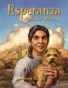
Review the “Arizona Rainfall” map. Notice the map is displaying the average information about a normal rainfall year in Arizona. AZ has been in drought conditions for the past decade, meaning AZ is getting less rain than the map shows. View the drought conditions monitor at Click to View the Drought Conditions Monitor. In Chapter 14, page 137 of Esperanza Means Hope, Esperanza and Carlos get caught in a sudden rain downpour. Describe the cloudburst event in your own words in a written paragraph. Add a second paragraph about your own experiences with sudden and violent rainy weather in Arizona.
|
Review the maps showing Arizona watersheds. Watch the interactive clip about watersheds at the URL below:
Click to watch a video about Watersheds
Choose one watershed system and write a report about it. Refer to the “Watershed Report Guidelines” to help you organize your report.
You may wish to choose either the Santa Cruz or San Pedro watersheds for your report because both regions were important to Esperanza and her family. |
Watershed Report Guidelines
Bill Williams River
Include the following types of information in your report:
- Visuals of flora and fauna native to the watershed; fish and fowl are native to the area
- Smaller tributaries (creeks, and/or lakes not included in the principal tributaries labeled on the map)
- Data about the principal bodies of water in the watershed (i.e. length and width of the rivers, etc.)
- Cities and/or towns located within the watershed
- Significant landforms – natural and manmade (i.e. mountains, buttes, valleys, dams, etc.) in the region
- History of the watershed region (i.e. Who was Bill Williams and why did he have a river named after him? Is an Indian Reservation within the boundaries of the watershed? What early peoples settled in the region? Did any big historical events happen near the main tributaries?)
- Environmental health of the watershed (i.e. Is the river polluted? Is it filled to capacity? What efforts are being made to protect water resources in the watershed region?)
- Recreational activities within the watershed (i.e. Is boating, fishing, swimming and camping allowed? Is it part of a state or national park? Is it in a protected wilderness area?)
- Visuals of the principal rivers (and other bodies of water) and scenic vistas within the watershed
Report Requirements
- Typed one page of text or hand written two pages of text (minimum)
- Cover page with name of watershed, visuals and student name
- Appendix with labeled additional visuals
- Self-assessed using the writing process (prewriting, draft, revise, edit, and final copy)
- Pages numbered
- Works Cited page (Internet sources, book sources, multimedia sources)


 Read the Biomes Data Table to learn more. Then make a Biomes Mobile using the name cards provided and following the directions for mobile construction.